By plane
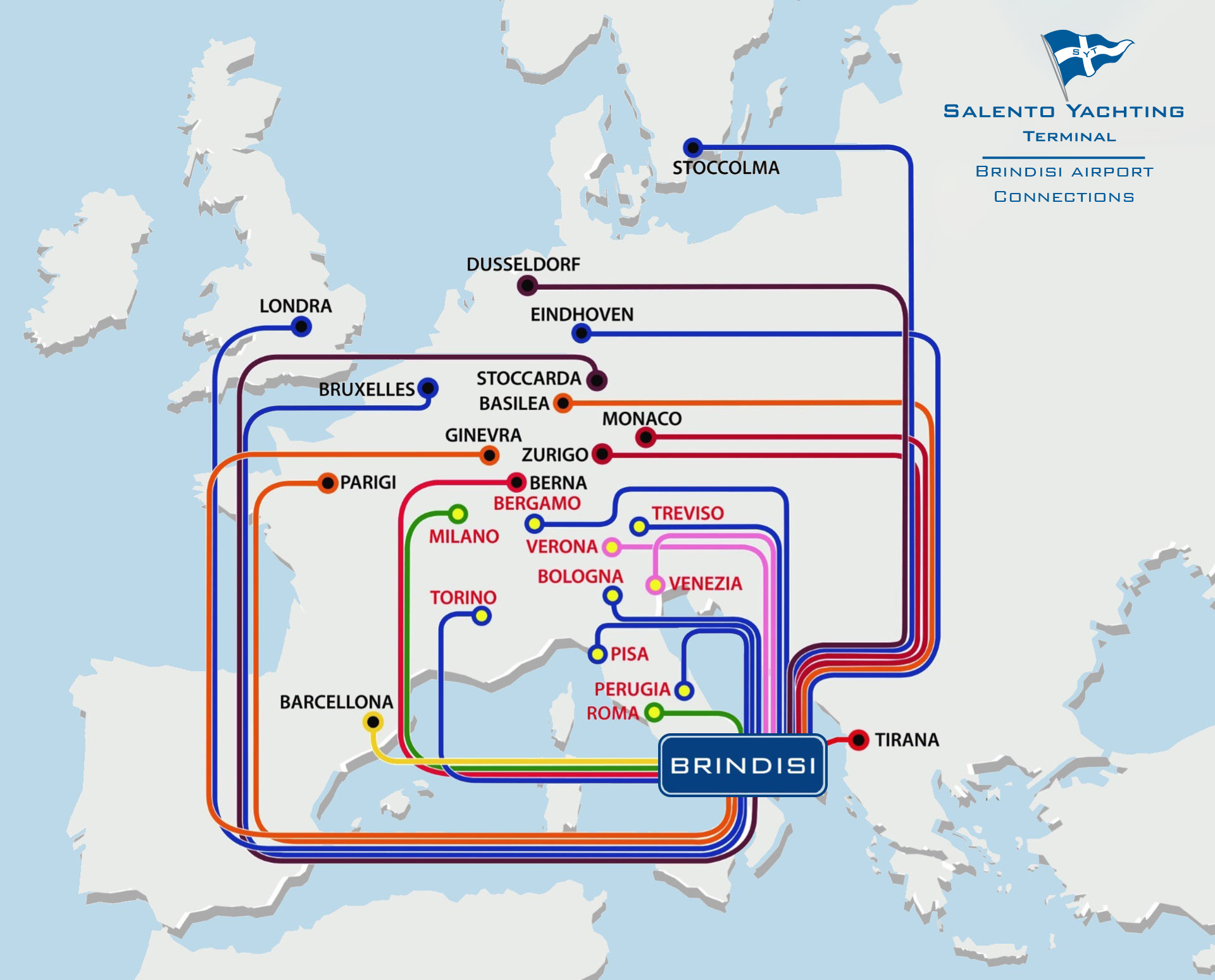
Salento Airport is 6km from the centre of Brindisi and is well connected to the main European airports: BOLOGNA, BRUSSELS, EINDHOVEN, GENEVA, BARCELONA, LONDON, MILAN, MONACO, PISA, ROME, TURIN, VENICE, ZURICH. Check the map or visit the airport official site.
By train
Brindisi is connected to all the major Italian cities by train. Consult Italian Railways website.
By car
Coming from the North on Autostrada Adriatica A-14 (Bologna - Taranto) or A-16 (Napoli-Canosa di Puglia) take the exit Bari-Nord and take the A-14/E55 towards Bari/Brindisi Centre, take the SS16 and continue on the E55/SS379 towards Brindisi until you reach the city.
Coming from the South on the SS106 Jonica (Reggio Calabria-Taranto) take the E90/SS7 at the junction for Grottaglie/Brindisi and continue to the city.
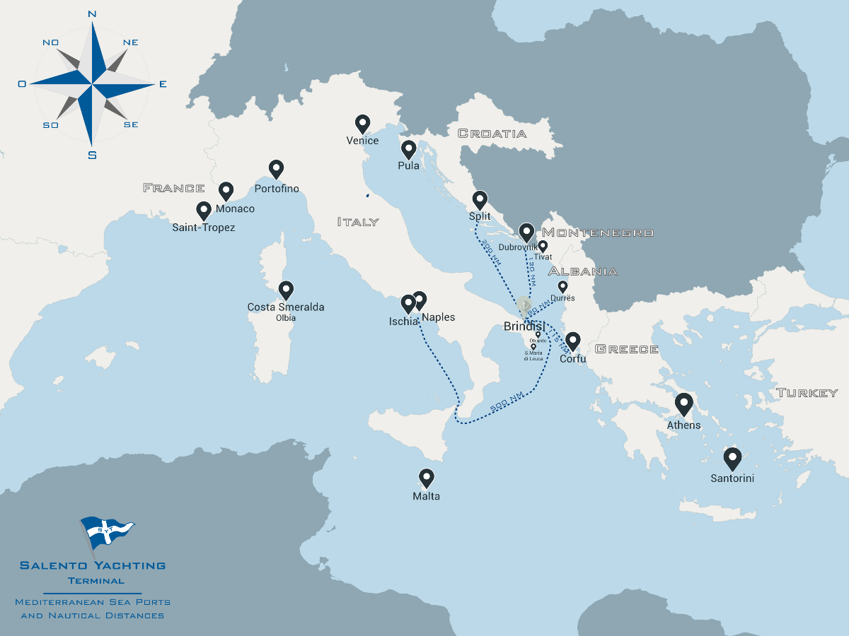
Our office is located on the waterfront.